

TOLEDO, Ohio — Throughout the past 10 days, we have had four to five different weather systems roll through, bringing both wet snow and fluffy powdery snow throughout northwest Ohio and southeast Michigan. As you may have noticed, not all snow is alike.
When meteorologists forecast snow events, each one is different because of snow profiles, which are determined by the ingredients in the atmosphere. These ingredients determine the consistency of snow, as well as how many inches of snow you can expect.
The snow-liquid ratio is the amount of liquid produced after the snow is melted. When temperatures are warmer, say in the middle to upper 30s, the air can hold a higher amount of water vapor (moisture), leading to a lower snow-liquid ratio. This results in bigger, heavier and wetter snowflakes.
Standard snow occurs at a 10:1 snow-liquid ratio, which happens when temperatures are near or at 32 degrees. This means if you melted 10 inches of "standard" snow that fell during a 32 degree day, you would get 1 inch of water.

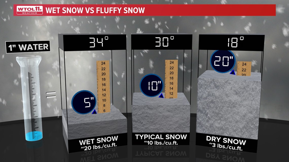
When temperatures are colder, the air can't hold as much moisture which leads to light, fluffier snow. For example, if snow falls when the temperature is 18 degrees, the snow-liquid ratio is 20:1. This means 20 inches of snow would melt into 1 inch of water.
By contrast, on a day when temperatures are just above freezing, at approximately 34 degrees, the atmosphere can still produce snow -- it will just be a very wet snow, coming in at a 5:1 ratio.
Snow in the upper Midwest usually errs on the side of fluffy. Studies indicate a 12:1 ratio may be representative of average snowfall in regions like Ohio and Michigan. Nonetheless, there are many variables that can affect the ratio of liquid to snow.
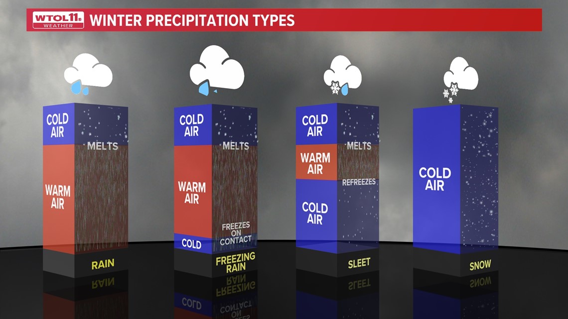
Below is an image demonstrating how different types of winter precipitation form.

With more snow on the way for Thursday and Friday's ALERT DAY forecasts, be prepared for several inches possible. Stay with the WTOL 11 Weather Team on air, online and on our free mobile app for the latest forecast.
MORE FROM WTOL 11