
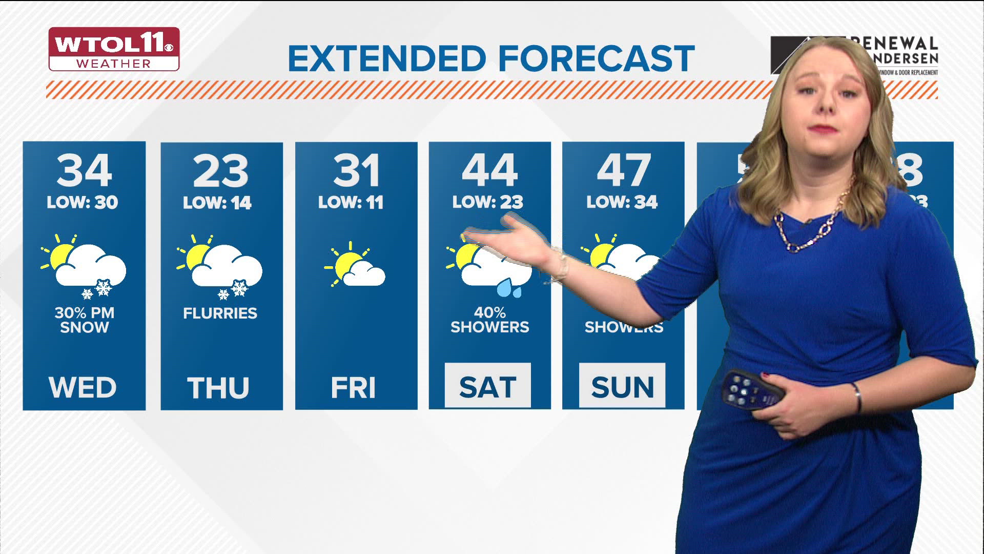
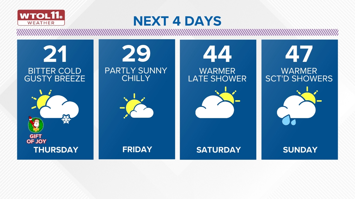
TOLEDO, Ohio — It will remain mainly cloudy on Wednesday with highs steady in the low 30s. Winds may gust up to 30-35 mph.
A few quick-moving snow showers will pass through the area Wednesday evening and early in the overnight with the arrival of an Arctic front.

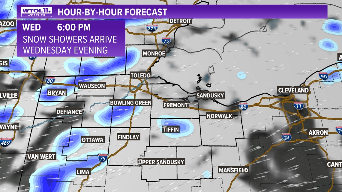
Any snow showers will be brief and scattered with little to no accumulation.
Winds late Wednesday evening and overnight will gust up to 35 mph.
It will turn bitterly cold Wednesday night into Thursday morning.

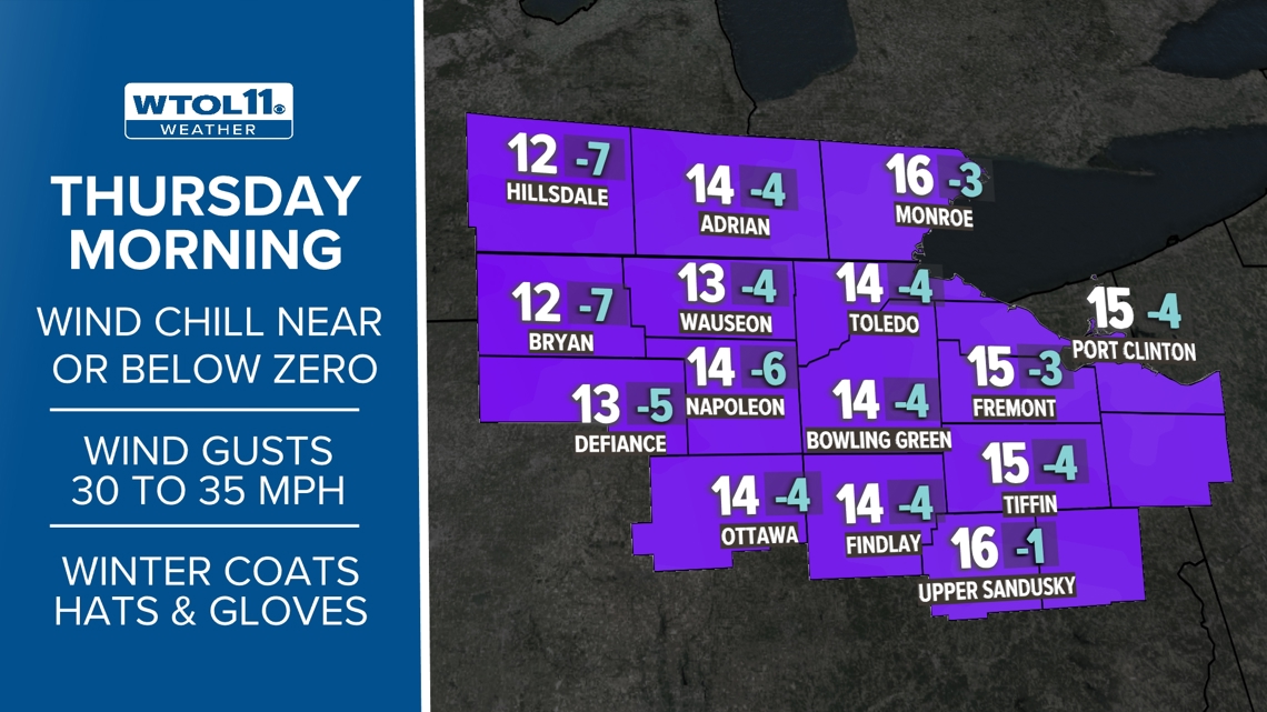
The wind chill will drop to near or below zero early Thursday with the "Feels Like" from zero to -5 below zero.
Additional snow flurries will continue Thursday on a very cold and brisk day.

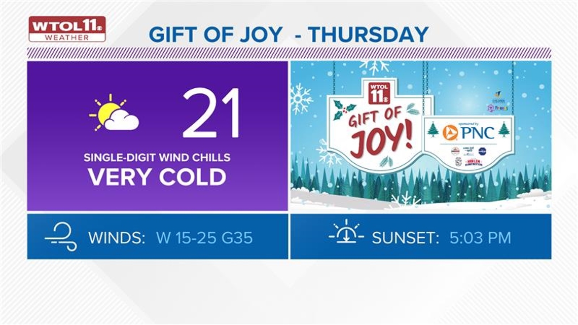
The wind chill will remain in the single digits and low teens through the afternoon with highs in the low 20s.
Highs remain very cold on Friday, only near 30 degrees.

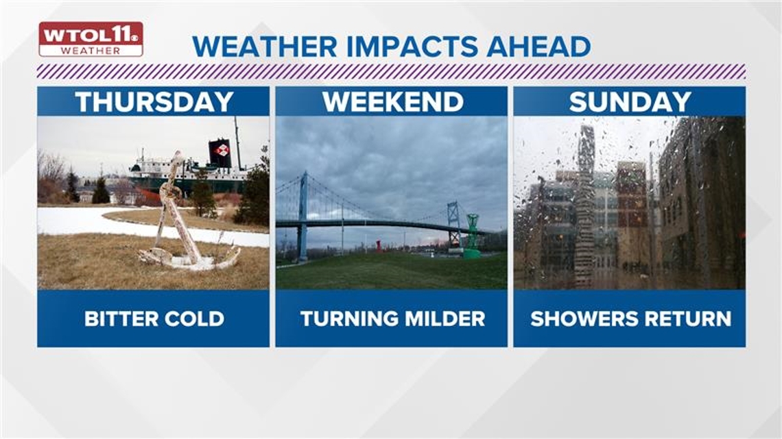
On Saturday, it will turn a bit warmer with the return of scattered rain showers in the afternoon and evening.
Highs will climb back into the middle 40s on Saturday, with temps in the middle and upper 40s on Sunday.
Additional rain showers are likely on Sunday and will be possible early next week on Monday.

Check out just a few features of the free WTOL 11 Weather app with WTOL 11 Meteorologist Kaylee Bowers:
What's the weather like where you are?
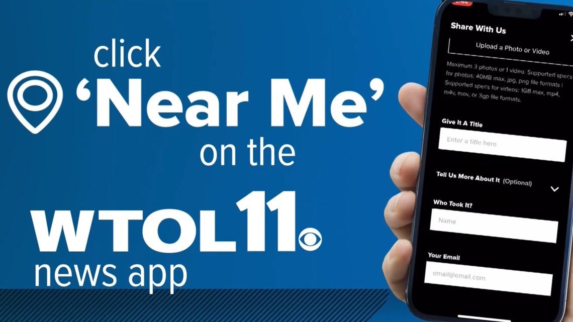
Share your photos by tapping "Near Me" on the WTOL 11 News app navigation bar at the bottom of your screen! Be sure to give us your name and you may just see your photos on air.

MORE weather stories on WTOL:
Want more from WTOL 11 News?
➡️ Download the WTOL 11 news app for Apple here or get it in the Google store here.
➡️ Get a fresh start to your morning and wrap up your day with the latest news and your WTOL 11 Weather forecast delivered right to your inbox!
➡️ Looking for the lowest current local gas prices? Check out the WTOL 11 gas price tracker, powered by Gas Buddy, here.
➡️ Stay up to date on what's happening in your community with a 24/7 live stream and on-demand content from WTOL 11+. Our free WTOL 11+ apps are available on Roku and Fire TV.
WTOL 11+ features the latest breaking news and weather, plus daily talk shows, coverage of your favorite sports teams from Locked On, fact-checking from VERIFY and the latest trending stories.