
TOLEDO, Ohio —
Sunday Morning Weather Forecast
- Most rain showers will taper by Sunday afternoon
- Overnight lows to fall into the upper 30s.
- Briefly drying out Monday evening
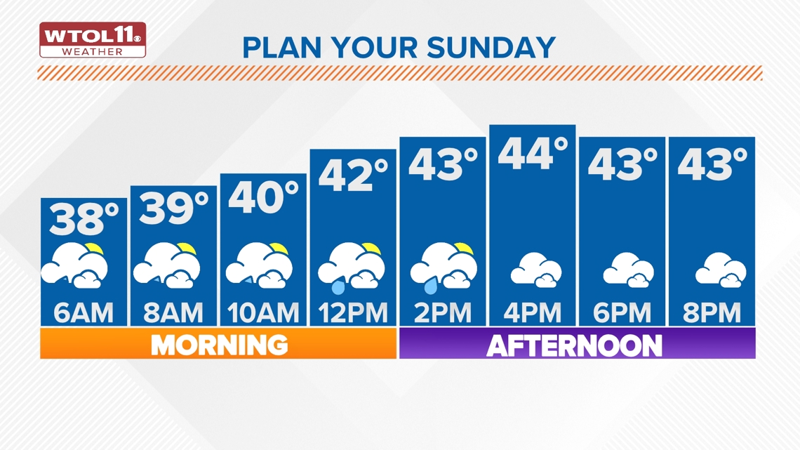
Rain showers have arrived for the start this Sunday, as most areas deal with a cold soaking rain for this morning.
With surface temperatures near freezing, a brief period of wintry mix or freezing rain is possible along and north of the state line.

Widespread travel impacts are not expected, though a few slick spots may develop on bridges and overpasses as well as neighborhood streets and untreated roadways.
Showers will move east of Toledo after daybreak, gradually clearing out by midday.
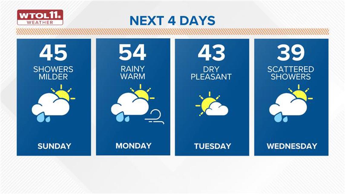
Sunday afternoon will bring mild and cloudy weather with temperatures in the mid-40s.
A few lingering showers may persist, but widespread soaking rainfall is not expected during the afternoon.
Sunday’s rainfall totals are expected to amount to 1/2” to up to 3/4” southwest of Toledo.
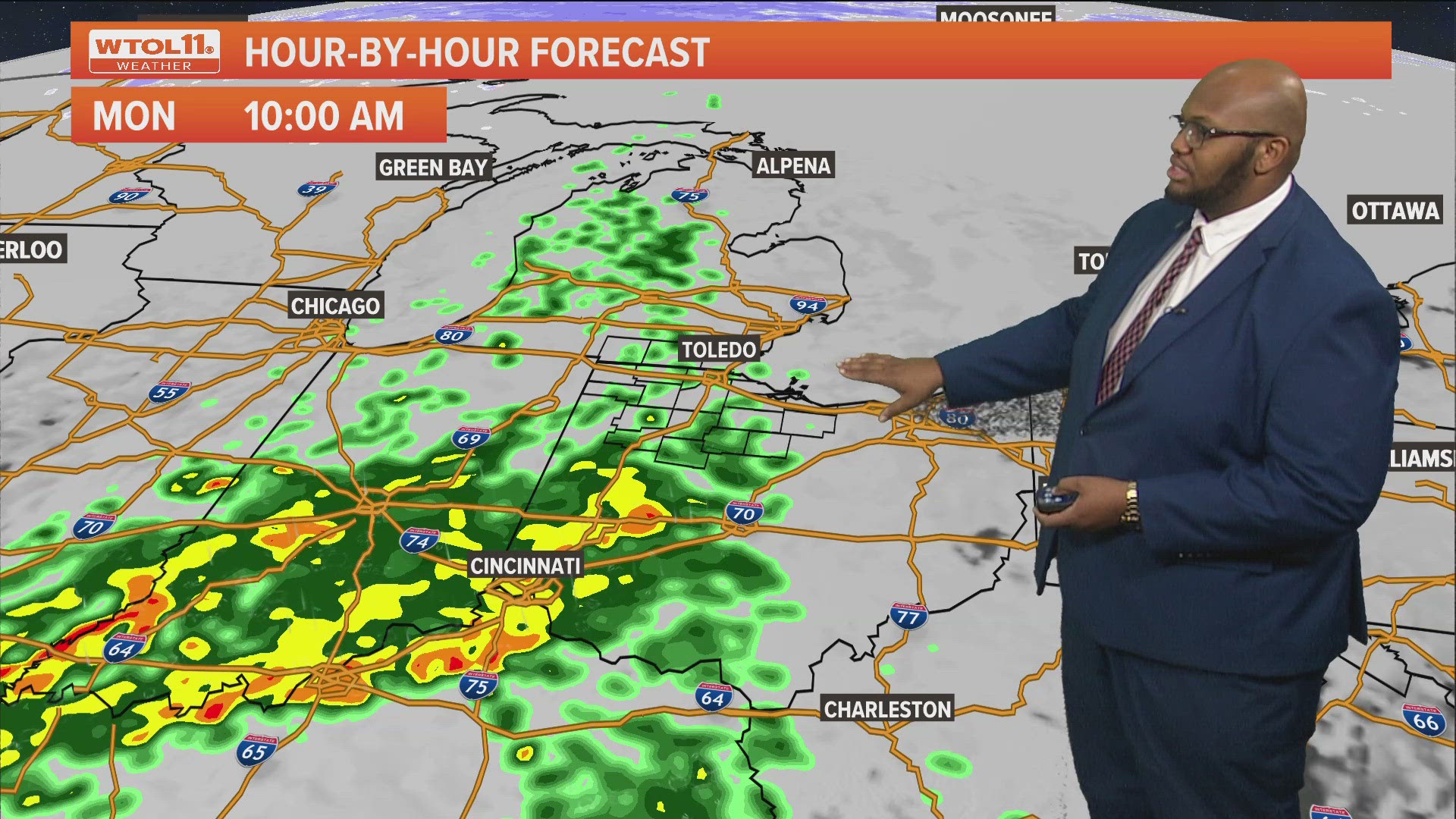
More rain showers arrive for Monday morning as we continue this wet pattern, more heavier pockets of showers will be possible with a few rumbles of thunder as well for Monday.
It will be quite the mild day as well with highs topping off just into the mid-50s for Monday and rain showers will finally come to an end by Monday evening.
Tuesday welcomes in some much drier and cooler weather for this week as temperatures fall back into the low 30s. Expect partly sunny skies and a calmer and pleasant feel.

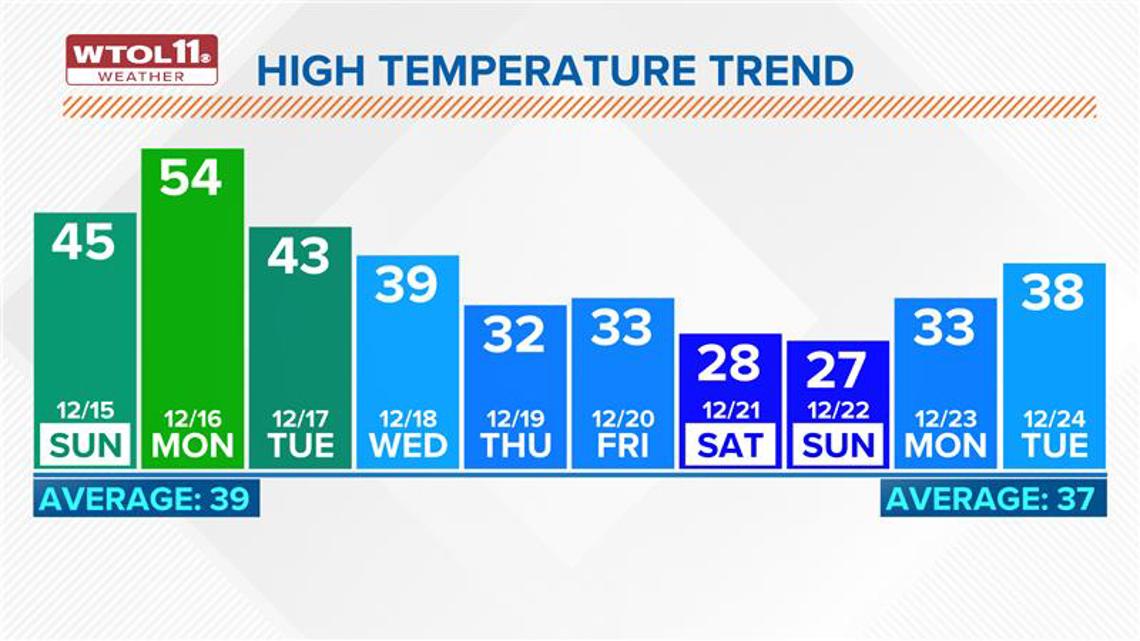
Another system may move through the region Wednesday, delivering additional rain showers.
This system will drag in another cold front that’ll send temperatures dropping near freezing for the tail end of the workweek.

Looking ahead to next weekend, a few snow flurries may fly on Saturday, the first day of the winter season.
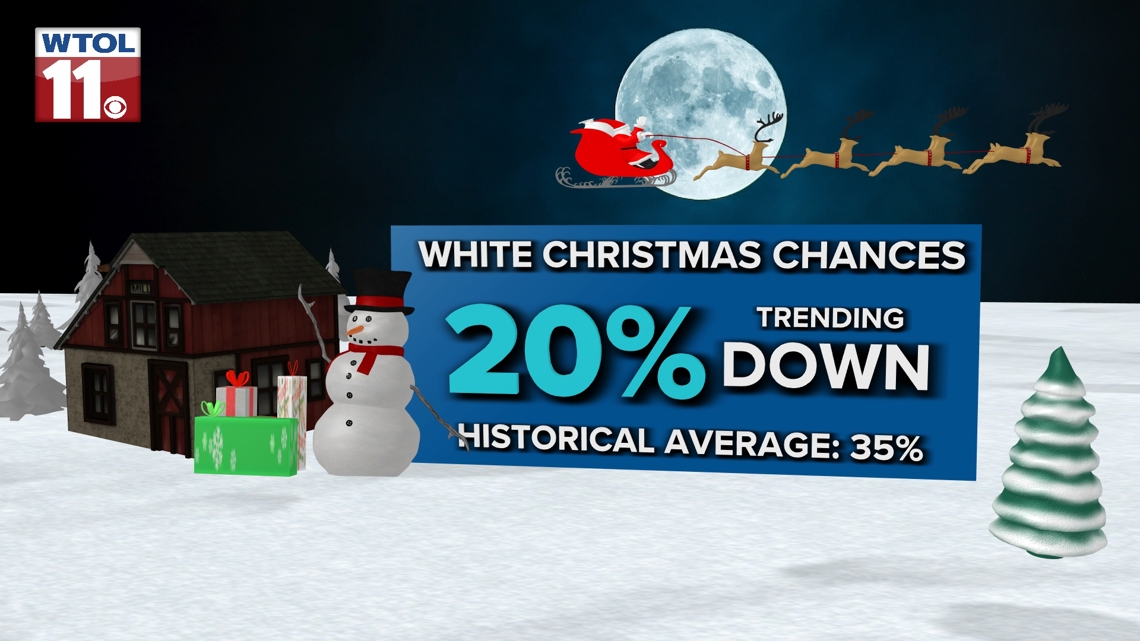
At this point, the chances of a white Christmas look fairly low, but stay tuned to the WTOL 11 weather team for the latest holiday forecast!

Check out just a few features of the free WTOL 11 Weather app with WTOL 11 Meteorologist Kaylee Bowers:
What's the weather like where you are?
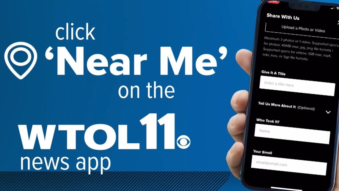
Share your photos by tapping "Near Me" on the WTOL 11 News app navigation bar at the bottom of your screen! Be sure to give us your name and you may just see your photos on air.

MORE weather stories on WTOL:
Want more from WTOL 11 News?
➡️ Download the WTOL 11 news app for Apple here or get it in the Google store here.
➡️ Get a fresh start to your morning and wrap up your day with the latest news and your WTOL 11 Weather forecast delivered right to your inbox!
➡️ Looking for the lowest current local gas prices? Check out the WTOL 11 gas price tracker, powered by Gas Buddy, here.
➡️ Stay up to date on what's happening in your community with a 24/7 live stream and on-demand content from WTOL 11+. Our free WTOL 11+ apps are available on Roku and Fire TV.
WTOL 11+ features the latest breaking news and weather, plus daily talk shows, coverage of your favorite sports teams from Locked On, fact-checking from VERIFY and the latest trending stories.