
PUTNAM COUNTY, Ohio — A brief EF-0 landspout tornado touched down in Putnam County Tuesday afternoon, according to the National Weather Service Northern Indiana.
According to the WTOL 11 Weather Team, the funnel cloud formed near Leipsic and McComb around 2:45 p.m. and was spotted near state Route 65 and Road H5.
The tornado was short-lived and on the ground for one minute with a path length of 0.21 miles. It had a speed of 70 mph and a width of 50 yards. No injuries were reported.
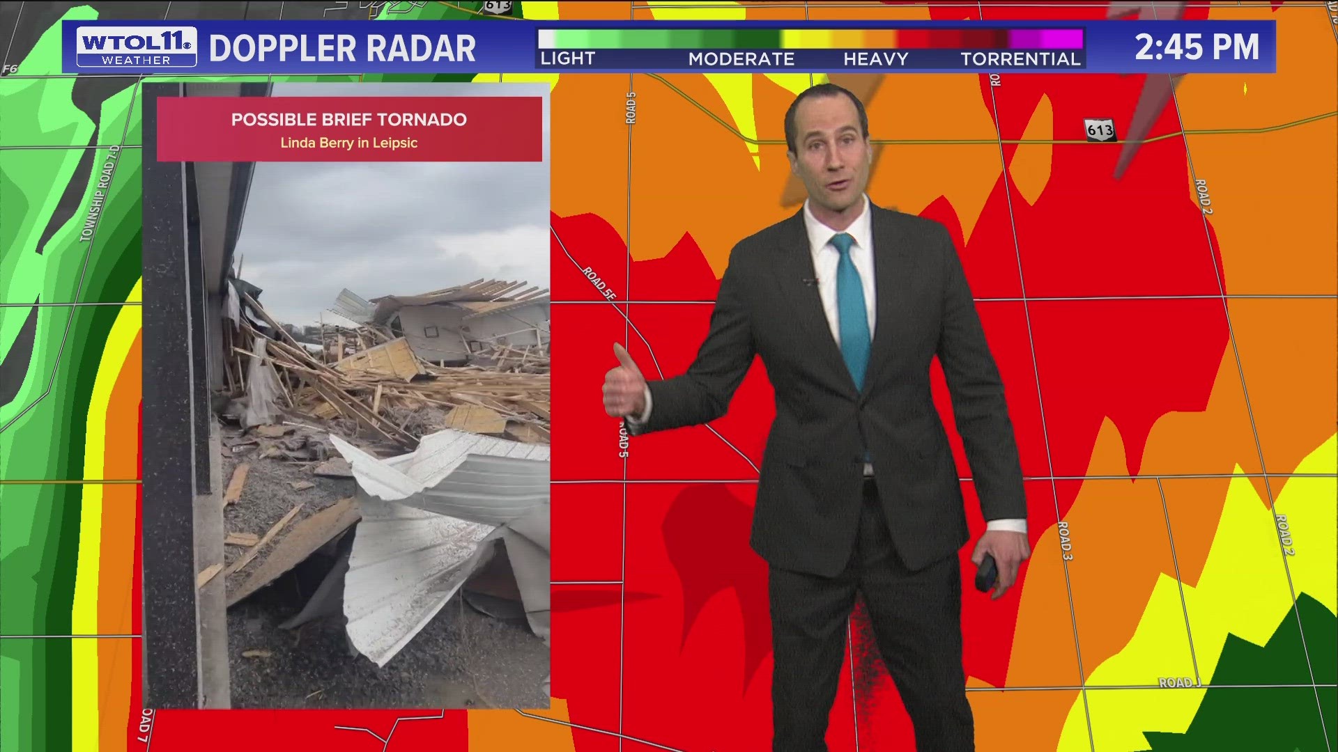
The tornado damaged a home on H5, causing the loss of the roof, shingles and some siding.
"A poorly built attached garage collapsed, and debris could be seen scattered to the northeast of the home," according to the NWS. "The tornado quickly dissipated in an open field just north of the intersection of Road H5 and Road 5H, just east of SR65."
In nearby Kalida, police reported on social media that the school district was delaying dismissal for students to allow the storm to pass. Children were scheduled to arrive home about 10-15 minutes later than usual, according to the social media post.
The Putnam County Sheriff's Office said in a press release Wednesday they received several 911 calls at approximately 2:42 p.m. regarding the tornado. In total, nine tornado siren sounded for 1 minute, 58 seconds, starting at 2:43 p.m.
Authorities responded to the scene they located the damage and spoke with homeowners, where they determined no injuries had been sustained.
The scattered spring thunderstorms moving through our region Tuesday afternoon can sometimes cause weak funnel clouds like the one reported in Putnam County, said WTOL 11 Chief Meteorologist Chris Vickers.
Viewer Linda Berry sent WTOL 11 the following video of the severe weather's aftermath:
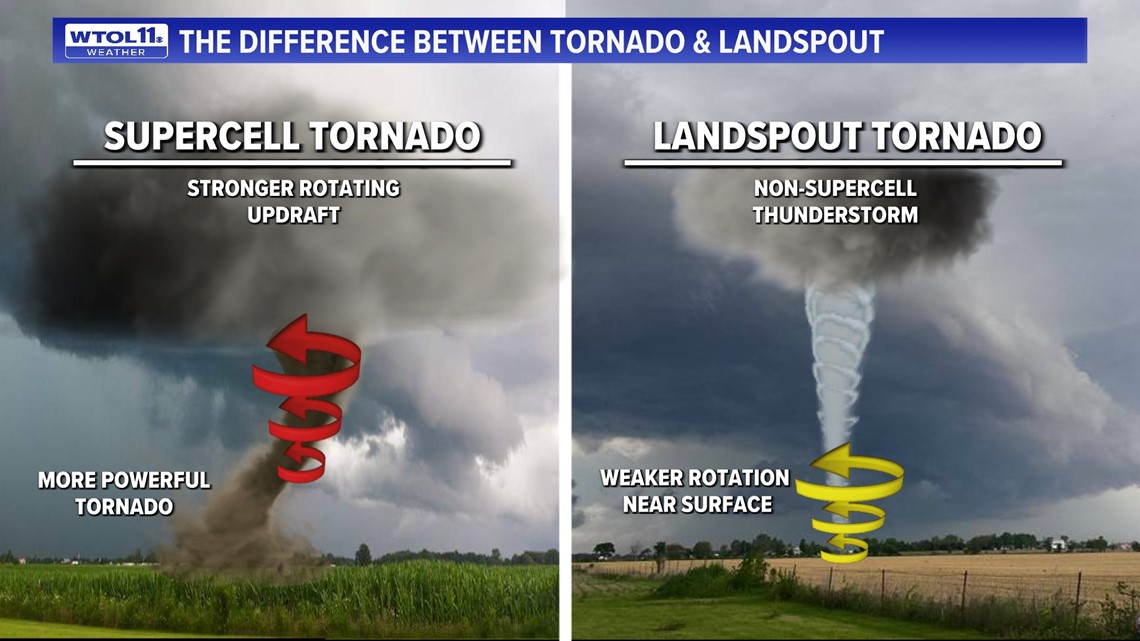
The difference between a tornado and a landspout tornado
A landspout tornado was the type confirmed in Putnam County. But what's the difference?
Landspout tornadoes differ from a more traditional tornado that we would experience in the spring and summer months with a supercell thunderstorm.
A tornado that develops from a supercell thunderstorm has a stronger rotating updraft that originates from the rotation in the cloud. This often produces a stronger and longer-lasting tornado.
A landspout tornado originates from a non-supercell thunderstorm. The rotation is weaker and originates near the surface and extends upward. This causes a landspout tornado that typically is much shorter in duration and weaker.

WATCH MORE FROM WTOL 11
Want more from WTOL 11?
➡️ Download the WTOL 11 news app for Apple here or get it in the Google store here.
➡️ Get a fresh start to your morning and wrap up your day with the latest news and your WTOL 11 Weather forecast delivered right to your inbox!
WTOL 11's Your Morning Blast and Your Evening Blast deliver stories from northwest Ohio, southeast Michigan and beyond to keep you informed.
Click here to get on the list!