TOLEDO, Ohio — Dry skies and even some sunshine are expected Wednesday with highs in the lower 70s.
Partly cloudy skies are expected Wednesday evening and very pleasant weather will continue overnight. Lows overnight and into Thursday morning will fall back into the upper 40s and low 50s.


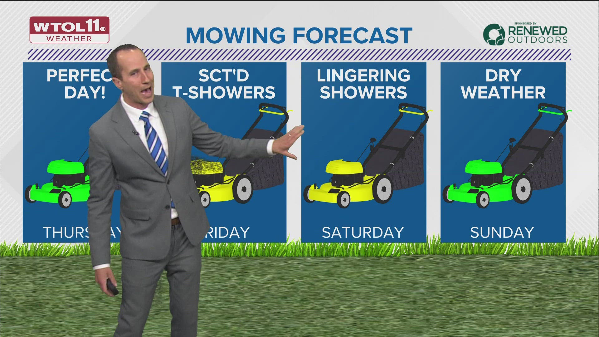
The weather will be dry and pleasant into Thursday with highs in the middle and upper 70s under partly sunny skies.
The next round of rain and a few thundershowers will be Thursday night into Friday. Rainfall on Friday alone may be an additional 1/4 inch to 1/2 inch through Friday evening.


Lingering showers will be possible again on Saturday morning.
Rain chances are most likely to end the first half of Saturday leaving much of the weekend mainly dry with highs in the 70s on Saturday and may push toward 80 or warmer on Sunday.


The potential for low 80s will continue into early next week on Monday and Tuesday.
Increasing chances of thunderstorms will be possible Tuesday and into Wednesday of next week.


Frost-free forecast
No more widespread frost is expected this season. We are now on the other side of Mother's Day and it is generally safe to plant outdoors with confidence. Our average last frost is May 8 and we are highly confident there is no frost in the next 10 days.
Frost has happened through late May and even into early June, but only in very rare circumstances. The latest frost/freeze on record for Toledo was actually June 11, 1972.


Ohio farming outlook
In the latest update from May 13, Ohio is ahead of the 5-year average on planting corn and soybeans despite large parts of central and northern Ohio receiving 150-200% of normal rainfall in the past 60 days. WTOL 11 Chief Meteorologist Chris Vickers suspects this is largely due to southern and central Ohio, with limited progress in northwest Ohio.


Download the free WTOL 11 Weather app
WTOL 11 meteorologist John Burchfield breaks down how the free WTOL 11 Weather app works for you:
MORE COVERAGE: More rainy and warm spring weather in northwest Ohio, southeast Michigan | Climate Friday
What's the weather like where you are?
Share your photos by tapping "Near Me" on the WTOL 11 News app navigation bar at the bottom of your screen! Be sure to give us your name and you may just see your photos on air.