
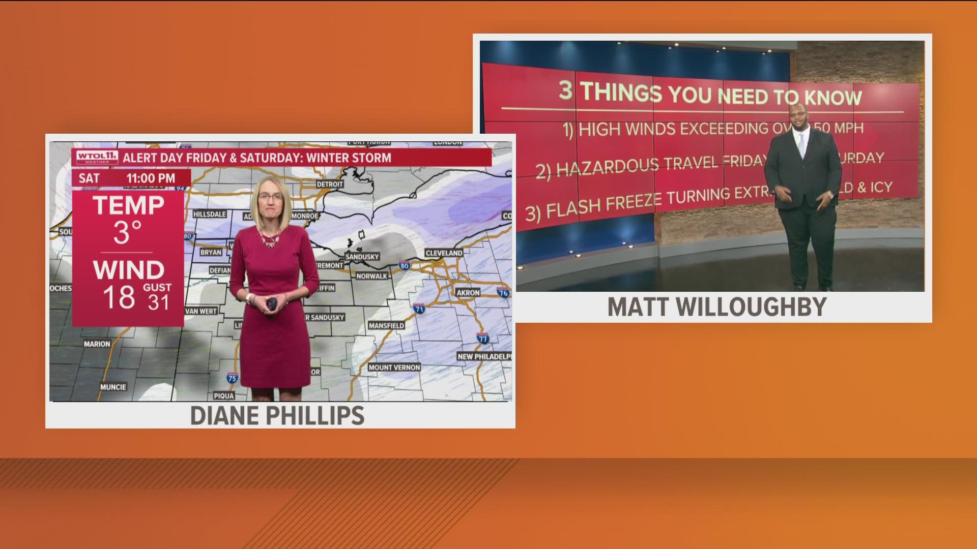
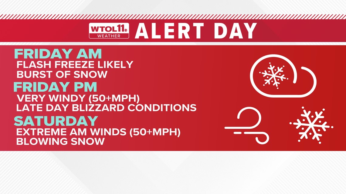
TOLEDO, Ohio — The WTOL 11 Weather team has declared an Alert Day for Friday into Saturday as a winter storm heads our way.
Here are three things you need to know about how high winds and snowfall could impact your travel this holiday weekend:
1. Wind gusts will stay mostly mild going into Thursday morning. By Thursday evening we will likely see wind gusts up to 20 to 30 mph.
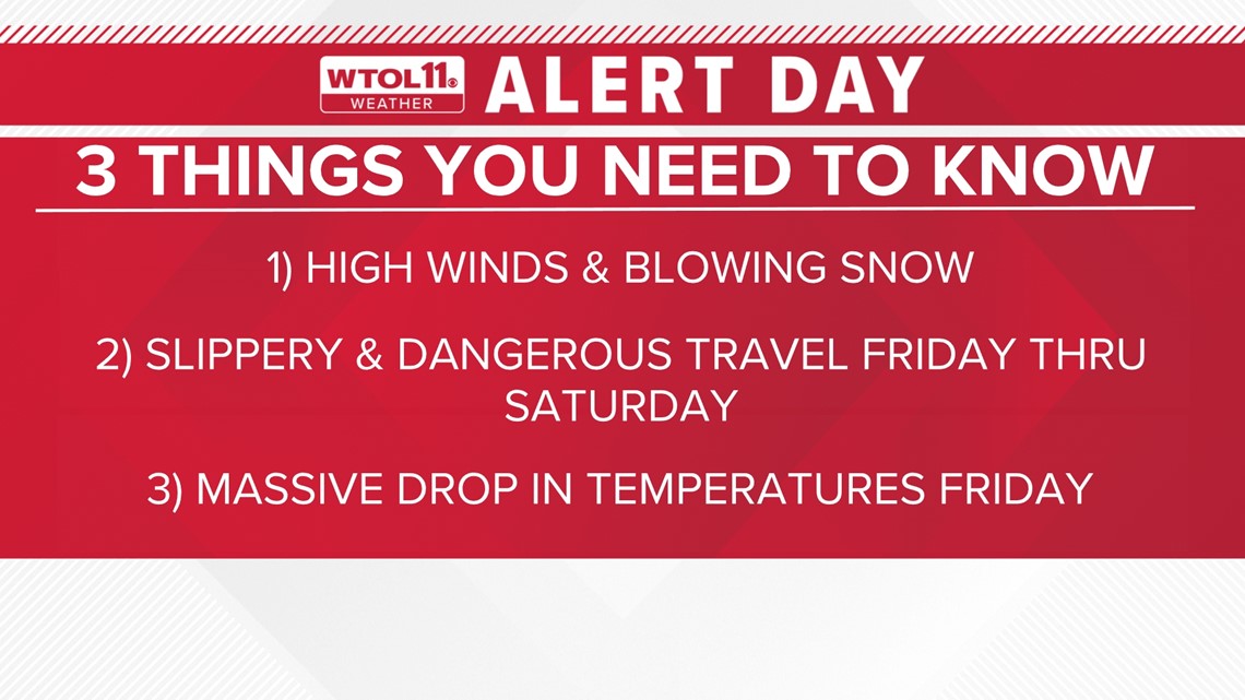
Friday morning through Friday evening with be the time to watch for high winds up to 50 mph. Many residents could lose power from the high wind speeds. The combination of extreme winds, and blowing snow, will bring visibility down to almost zero for driving.

2. Friday and Saturday will be two of the busiest days of travel for the year with the Christmas holiday right around the corner. Expect flight delays and busy interstates. Friday morning will be the trickiest day of travel as rain showers transition to snow showers, along with the temperature can cause road conditions to go from wet to icy roads.
By Friday afternoon, traveling will be difficult due to this winter storm that will bring accumulating snow on roadways to areas across the eastern portion of the U.S.
Any travel from Friday night to Saturday is not advised.

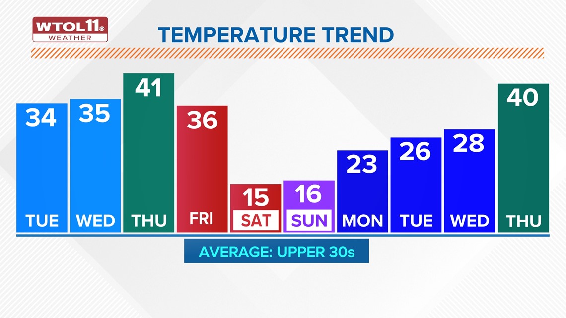
3. Temperatures will warm up closer to the lower 40s going into the overnight hours of Thursday night. A very strong cold front will approach from the west, bringing a massive drop in temperatures in just a couple of hours by Friday morning. The very quick drop will send temperatures falling over 20 degrees. By Friday afternoon temperatures will likely be in the single digits through Saturday morning.

RELATED VIDEO