
TOLEDO, Ohio — Love it or hate it, it’s going to snow this winter.
While each winter season is unique and can vary significantly, there are clues the WTOL 11 Weather team has been analyzing for the past few months that may impact the overall winter season.
First, this winter season is the third year of a La Niña, which is classified by cooler than average equatorial Pacific waters off the coast of South America.
This has impacts on overall global atmospheric circulation and has a strong influence on the polar jet steam. Winter seasons that have this pattern oftentimes favor a more active jet steam, especially in the second half of the winter season during a La Niña winter.

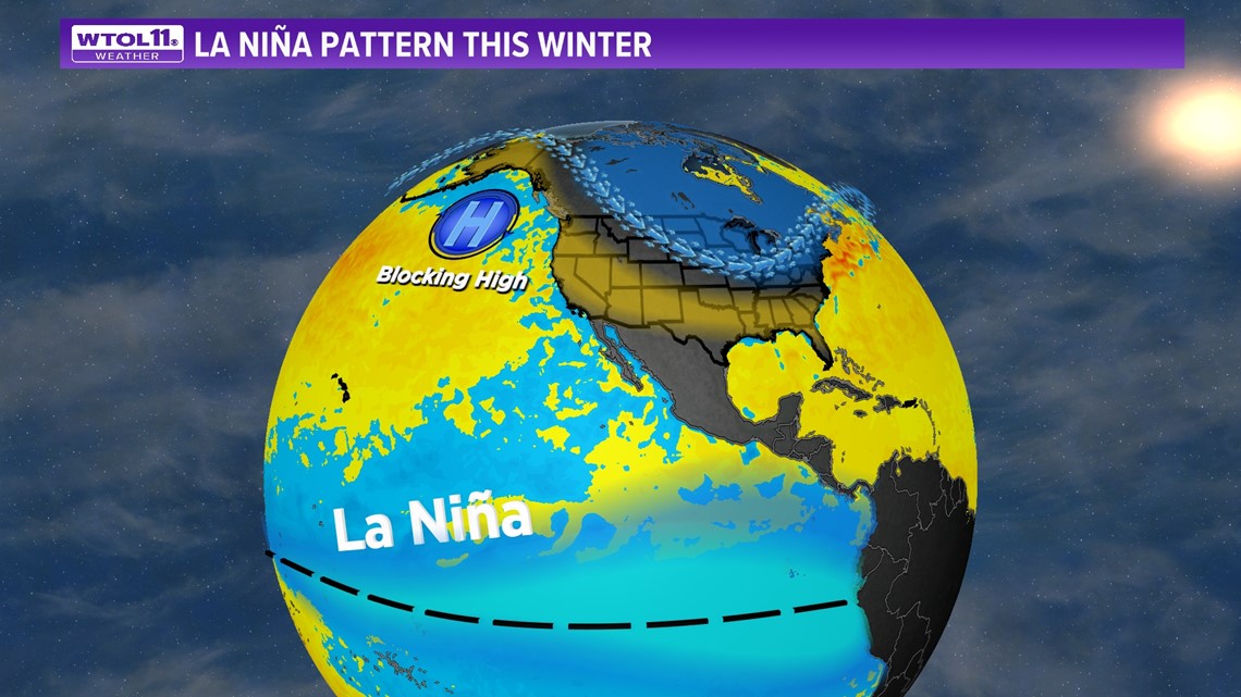
The past two winter seasons in La Niña have favored relatively mild weather and a significant lack of early snowfall. This was followed by significant and heavier snows in the month of February. Last February recorded 19.1 inches, and in the year prior there was a recorded 22.7 inches.
It's no secret that winter is just not as cold as it was decades ago, at least on average over time. This mirrors trends determined to be happening in the winter season in general, due to warming in the overall winter climate.

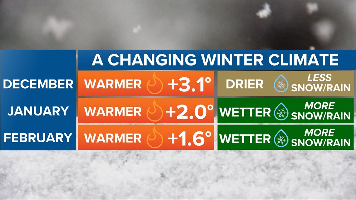
The month of December is 3.1 degrees warmer on average compared to decades ago. January and February mirror that trend of warmer temperatures when compared to previous climate normals.
Precipitation patterns reflect a drier and warmer trend for December with less rain and snowfall and a wetter January and February with more rain and snow.
The winter season hinges on the eventual split of the polar vortex, the atmospheric circulation high aloft in the atmosphere over the North Pole. The disruption allows some of the coldest air of the season to dive out of the polar Arctic and potentially into the northwest Ohio and southeast Michigan area.
But there is little evidence this will happen in the month of December. The likelihood of this may increase in mid to late January, and even into February. If this does happen, it opens the door to Arctic air, possibly coming from Siberia where greater snow cover and frigid air are often found.
WINTER WEATHER FORECAST
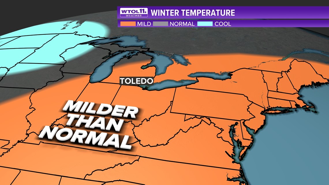
A warmer-than-average winter is likely. However, this may favor warmer-than-average temperatures in the first half of winter, with colder air more likely into the second half of the winter season.

Typical winter seasons hang on the split in the polar vortex and the magnitude of other indicators known as teleconnections -- Arctic Oscillation and North Atlantic Oscillation. These wild cards typically aren’t known until two to three weeks in advance.

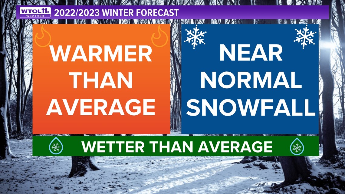
The overall winter precipitation is expected to be above average and consistent with a La Niña winter, but only to result in near-average snowfall somewhere in the range of 35-40 inches for the entire season.