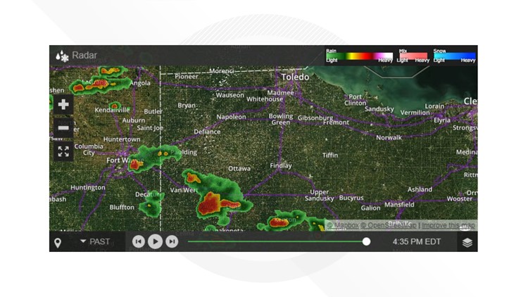
The National Weather Service in Northern Indiana at 4:29 p.m. issued a
Tornado Warning for southeastern Van Wert County in west central Ohio and southwestern Allen County in west central Ohio until 5:15 p.m. No severe threat is in the work for the Toledo area.
At 4:29 p.m., a severe thunderstorm capable of producing a tornado was located over Spencerville, or 9 miles south of Delphos, moving east at 30 mph. Flying debris will be dangerous to those caught without shelter and mobile homes could be damaged or destroyed. Damage to roofs, windows, and vehicles will occur and tree damage is likely, the NWS advises.
This dangerous storm will be near Fort Shawnee around 4:55 p.m. Other locations impacted by this thunderstorm include Conant, Monticello, Kemp and Hume.
This includes Interstate 75 between mile markers 119 and 121.
The NWS advises people in the affected area to take cover. Move to a basement or an interior room on the lowest floor of a sturdy building.Avoid windows. If you are outdoors, in a mobile home, or in a vehicle, move to the closest substantial shelter and protect yourself from flying debris.