
After a long stretch of frigid weather the pattern is changing.
This week will bring a spring-like warm up, followed by a possible major snowstorm, then back to bitterly cold over the weekend.

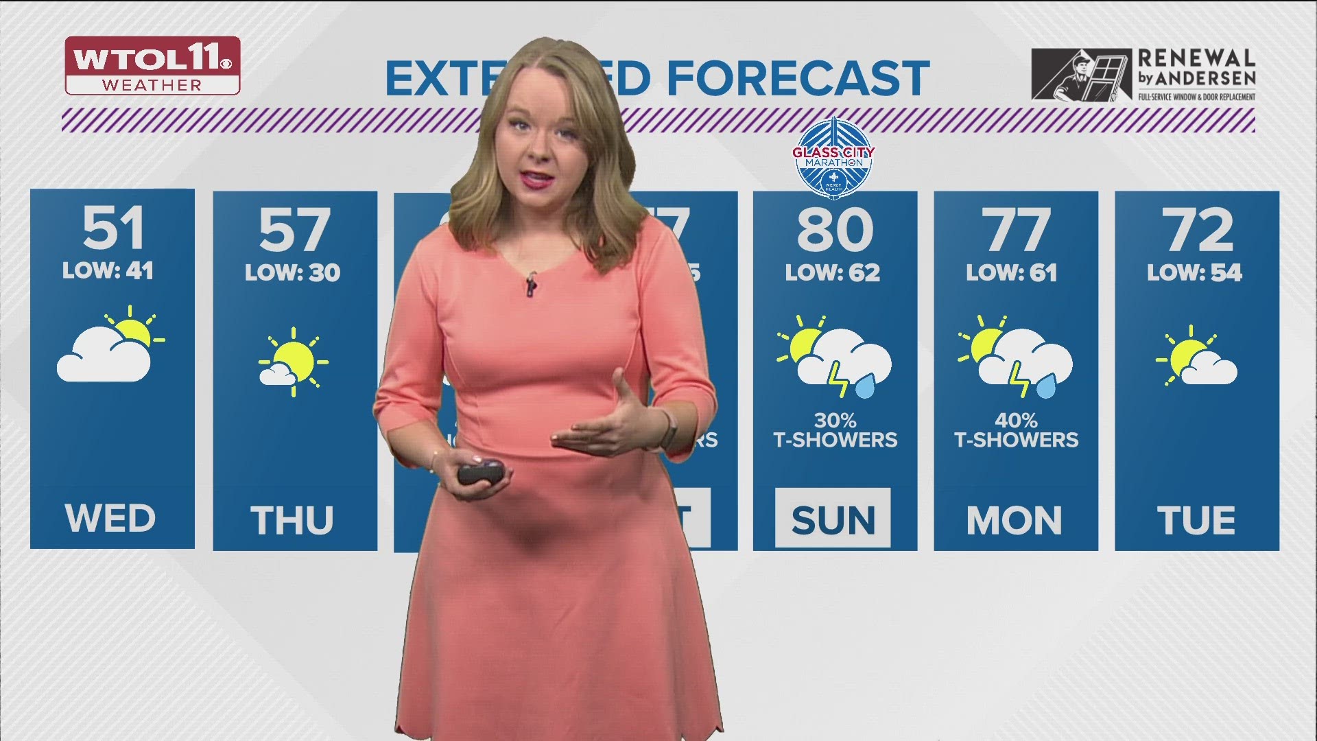
It will warm up quite a bit Wednesday, then Thursday temperatures will reach near what you would normally expect in early April.
The "January thaw" will not last long though.

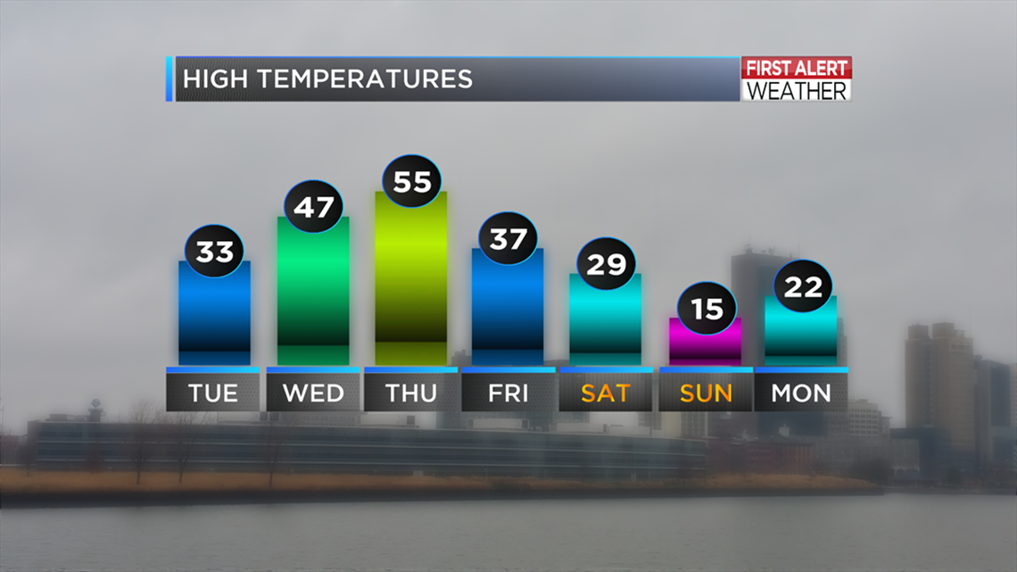
A storm system will shift winds to northerly Friday.
This will drop temperatures back to wintry in no time.
The change in weather from Thursday to the weekend will be drastic.
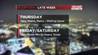
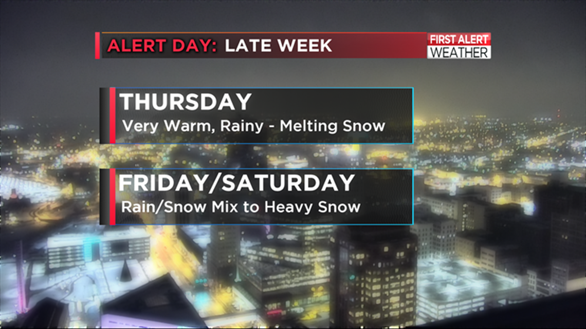
Breezy, rainy Thursday with rapidly melting snow.
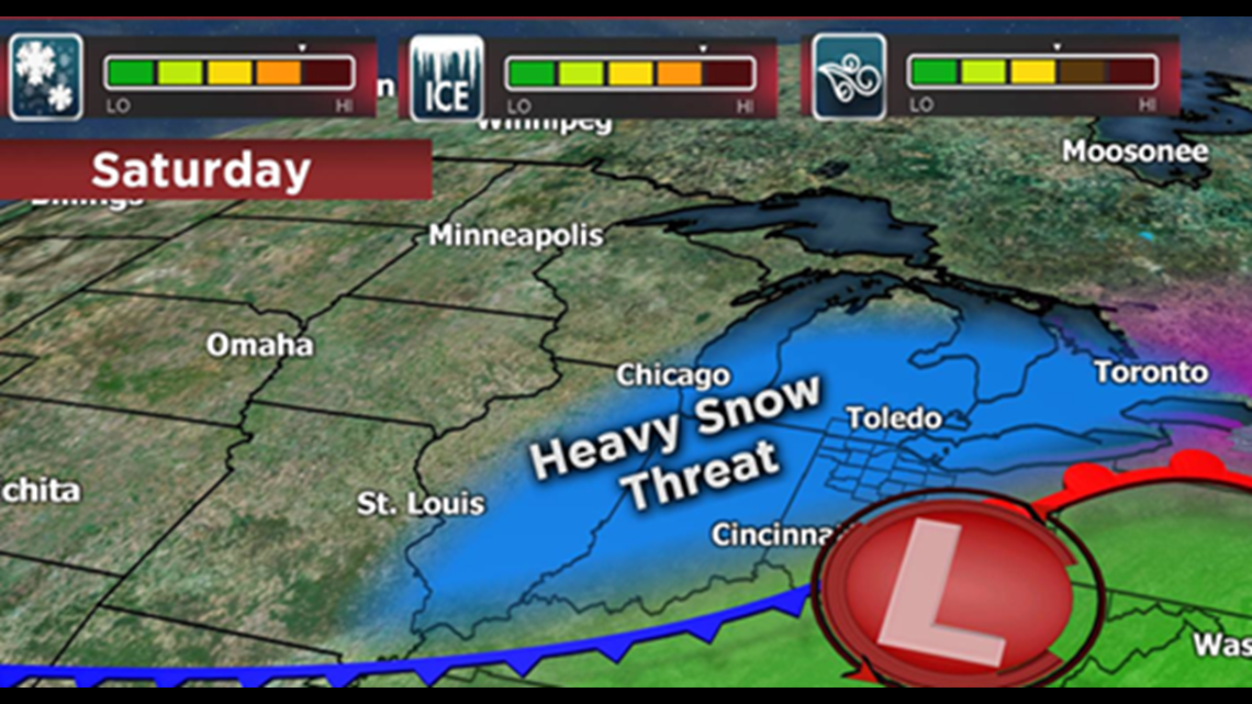
The next storm Friday, Friday night into early Saturday will bring rain and snow changing to all snow. Get the snowblower ready just in case.
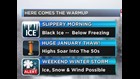
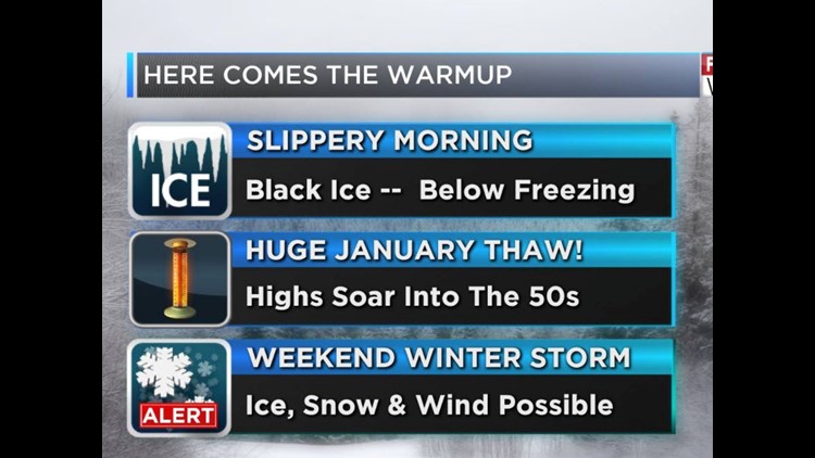
In the near term I have a warning for you overnight and Tuesday morning.
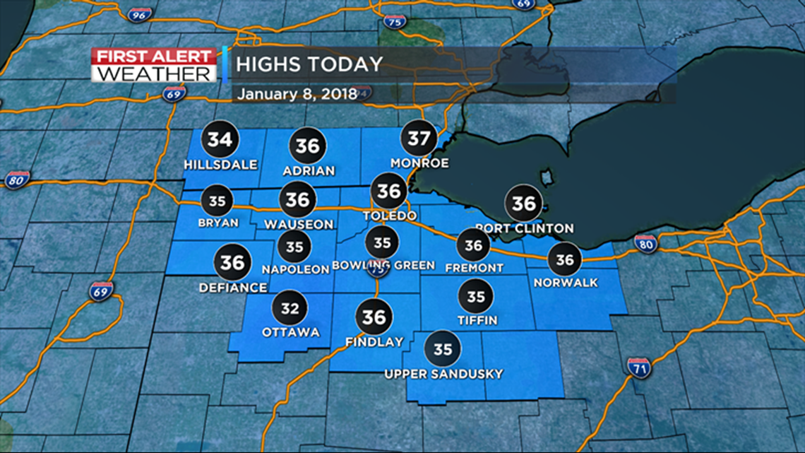
Temperatures above freezing Monday have allowed melting of snow and ice.

Tuesday morning temperatures will be cold enough for icy spots, especially on sidewalks, driveways, porches, parking lot surfaces.
This is the perfect set up for slip and fall accidents. Remind family and loved ones to be careful getting started - put your winter thinking cap on!
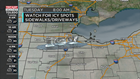

Roadways, especially bridges and overpasses, may have slick spots as well.
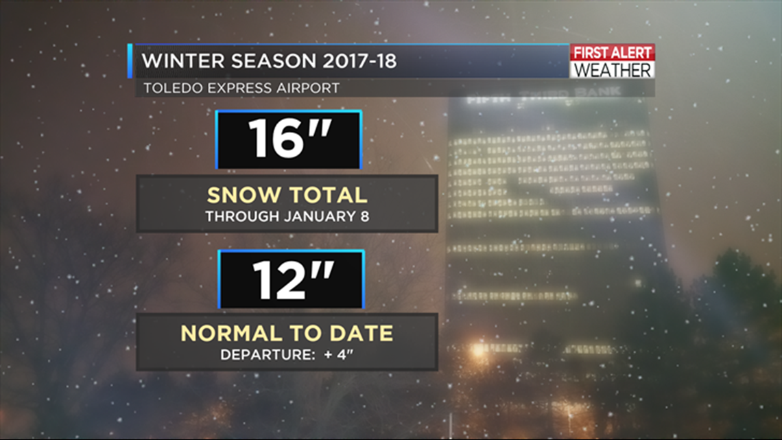
The snow total winter to date is 16". The next storm may bring a major snow of 6" or more to the area. Early indications are late Friday into early Saturday.
Travel plans early this weekend should monitor this storm closely.
The FIRST ALERT Team will keep you updated.

Robert Shiels WTOL