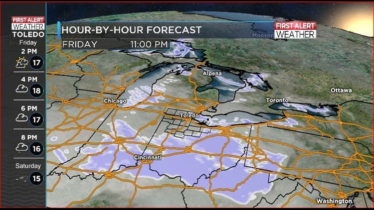

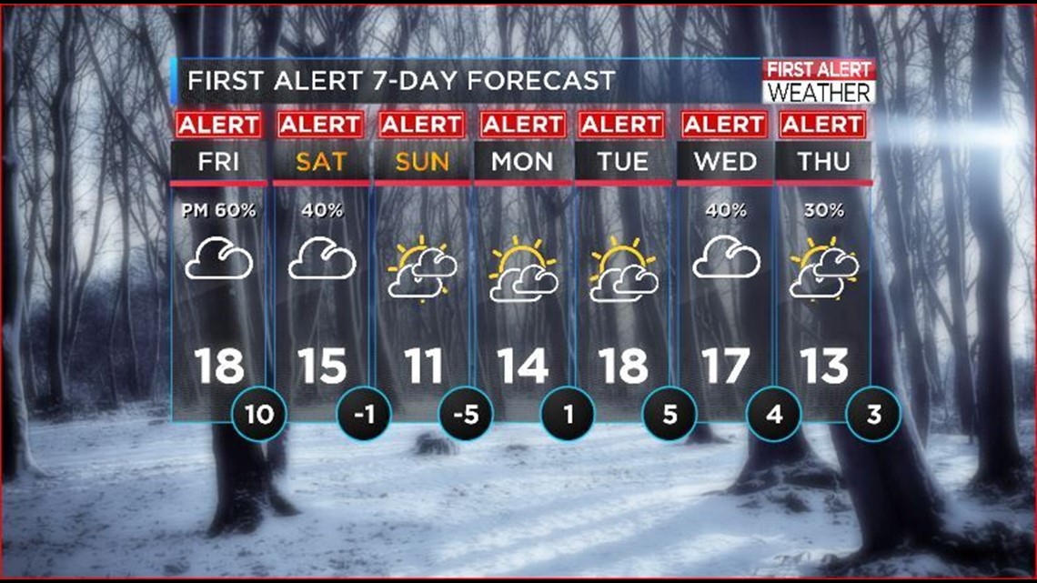
FIRST ALERT - FRIDAY - Bitter temps and light snowfall are expected today. Look for the high to land around 18, but the wind chill will make it feel like 5 degrees! Light snow is possible later tonight, especially for our southern counties south of Findlay.
FIRST ALERT - SATURDAY Look for less than an inch of snow by Saturday afternoon for most areas. Brutal winds will clock up to 30 miles per hour Saturday afternoon and could cause blowing and low visibility late Saturday.
FIRST ALERT - SUNDAY New Year's Eve. Temps will nudge just over 10 degrees, with wind chills below zero on New Year's Eve Day. The overnight low sinks to 5 below zero with the wind chill around 12 below as the ball drops.
FIRST ALERT DAYS continue into 2018 as our chance for snow increases and the bitter temps hold steady.