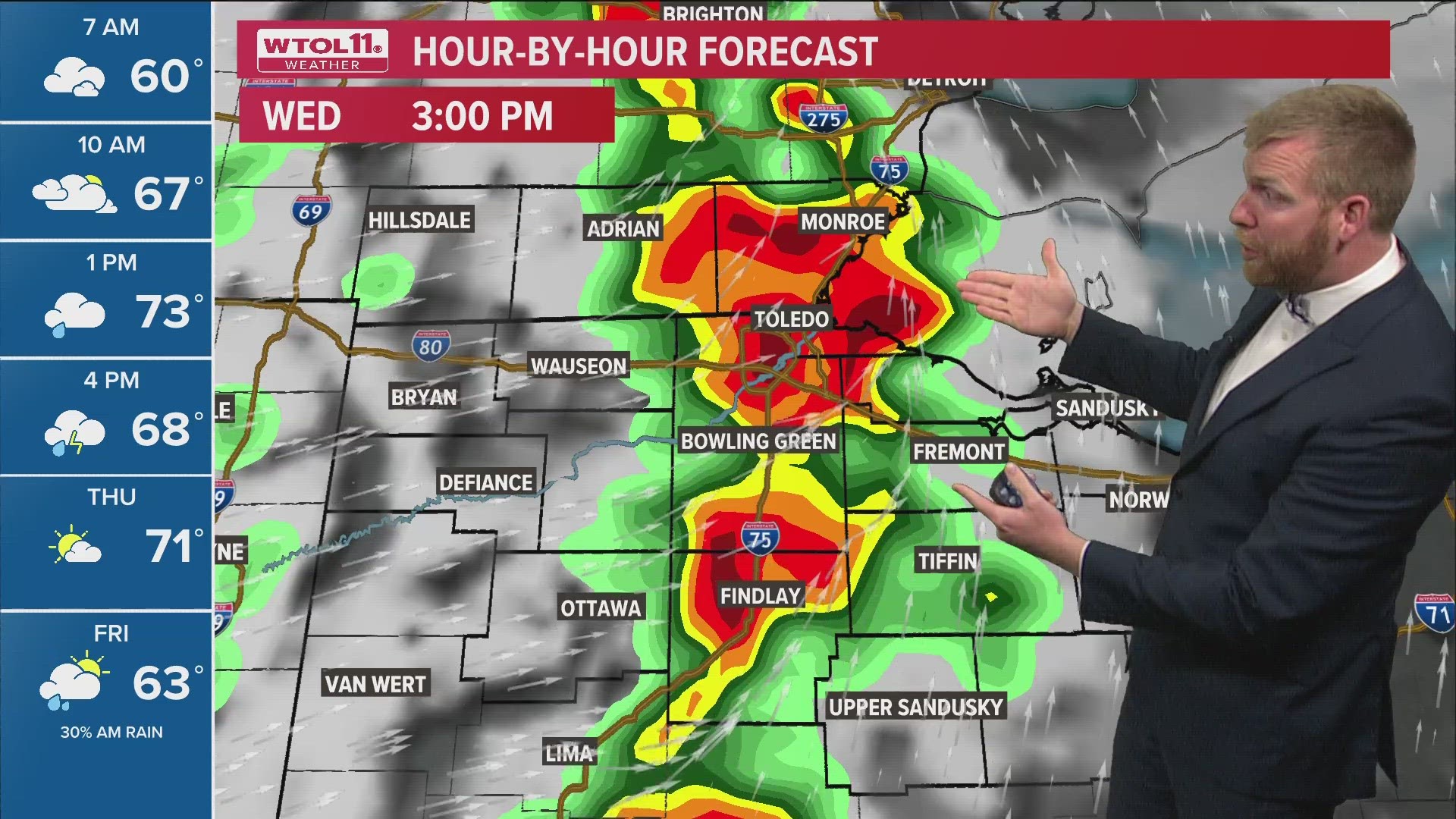
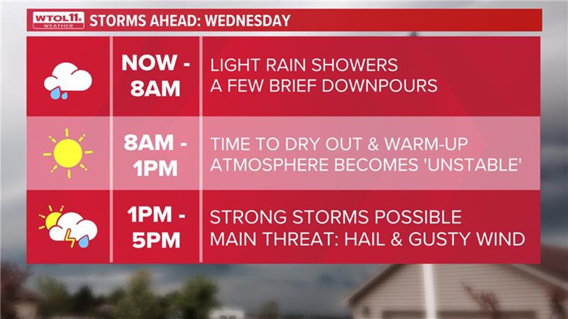
TOLEDO, Ohio — An ALERT DAY is in place Wednesday for the potential of stronger spring storms in the afternoon.
Scattered thunderstorms are expected between 1-5 p.m. and may produce strong gusty winds, hail chances, and an isolated tornado risk.
Once the line of storms passes, the atmosphere will turn more humid and dry with highs in the 70s for the remainder of the evening and through Thursday.
It begins to turn a bit cooler again on Thursday and Friday with highs back into the low and middle 60s.

A round of showers and rain is likely late Thursday night into very early Friday morning.
Cooler air settles in for the upcoming weekend with highs dropping all the way into the 50s. Despite the cooler feel, the sunshine will be out for most of the weekend.
Highs rebound back to the 60s next week, which is near normal for the end of April.
Download the free WTOL 11 Weather app
WTOL 11 meteorologist John Burchfield breaks down how the free WTOL 11 Weather app works for you:
MORE COVERAGE: More rainy and warm spring weather in northwest Ohio, southeast Michigan | Climate Friday
What's the weather like where you are?
Share your photos by tapping "Near Me" on the WTOL 11 News app navigation bar at the bottom of your screen! Be sure to give us your name and you may just see your photos on air.